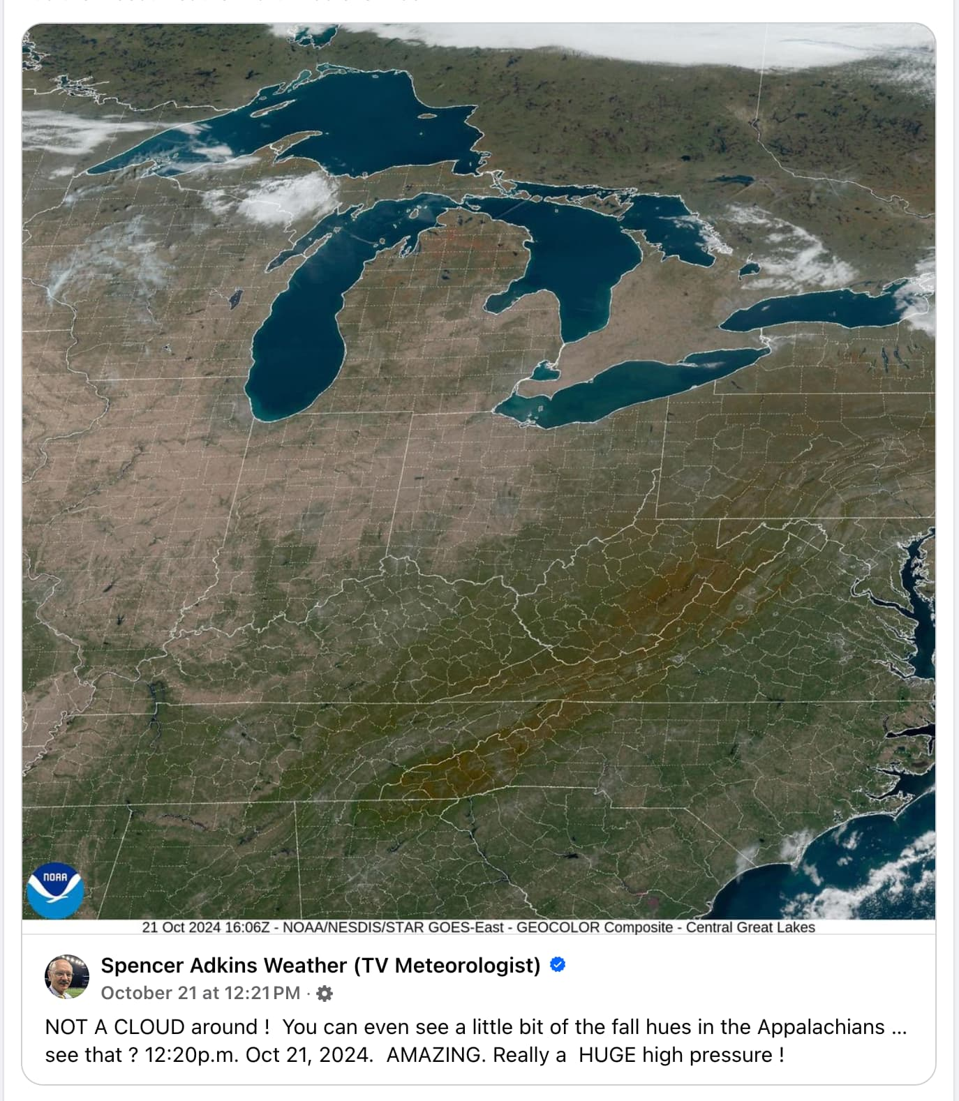
Whoa I didn't know you could see state and county lines from space. I guess maps are more realistic than I thought!
Mildly Interesting
This is for strictly mildly interesting material. If it's too interesting, it doesn't belong. If it's not interesting, it doesn't belong.
This is obviously an objective criteria, so the mods are always right. Or maybe mildly right? Ahh.. what do we know?
Just post some stuff and don't spam.
I'm no weatherologist, but I think those may just be temporary.
What does weatherology have to do with landology? Educate yourself
Do I look like someone who went to university college to you?
If I knew what those words meant, I'd probably be offended
If only I could read
There's some fanfiction out there that can make you regret learning language at all.
You could probably handle lots of different subjects, Squidster

I can definitely identify wood. I just woke up.
Those lines, too. Did they pick where the states and burrough were based on those white lines?
No, I'm pretty sure it's like a baseball game. Some dude runs out there every so often and chalks the boundaries a mile or so in width so you can see them from space
Gotta hate when a flood happens and all of a sudden Florida and Georgia become one state.
Florgia
Not all heroes wear capes.
No, England didn't set the borders on their way out, during this incident
This image also illustrates how artificially brown crop land is. I live in the intermountain west and didn't expect to see that ground color in Illinois, Indiana, and Ohio...
They've been in a drought most of the summer. But ya, also the crops have been pretty much all harvested before this picture was taken.
One of the things I definitely do like living in Indiana is all the trees. In L.A., where I lived for a decade, it was mostly palms and conifers, and then Joshua trees further out. And they're not all that attractive to me in comparison. Our house used to be surrounded by giant oaks that it was built around. Unfortunately we lost some in recent storms and others were too sick to not be a danger. We still have, I think, 5 of them left and a persimmon tree. We also have a playground that we're going to dismantle and replace with another tree. Something local that grows relatively rapidly. Maybe a pawpaw? Not sure yet. Terre Haute, where I live, is famous for its sycamores (to the point that it's the ISU sports team is the Sycamores), so that's an option, but they're kind of boring trees IMO.
I have a giant oak tree next to my house, perfectly positioned so that my house is in direct sunlight in the morning but completely shaded by the tree from noon onwards, so even when it's 100°F outside my house doesn't get above the low 80s. I love that tree - except for right now when I have to rake the fucking yard.
Ya, where I live, trees don't necessarily grow even along the river or in the mountains. Berry season is great, tho!
It is harvest season and most crops are brown when it's time to harvest.
Why are the city and county lines present?
Because they're always there, haven't you gone to the edge of your county and looked at the lines? My favorites are the ones that run right through man made stuff like streets and farms.
this is how I thought longitude and latitude worked when I was little. The boat captains would just go over it like a bump on the road
I wish the world worked the way we thought it did as kids. It would be so much more interesting.
I messed around with listening and decoding NOAA satellites at home and depending on the satellite they decode with the states outlined like this. It's a fun hobby that uses one of those digital antennas,some copper wire and some open source programs.
Would be better without the grid.
What do you mean? Those lines aren't really there? But they are crucial to electing the president. And the one at the very bottom is important to keep the brown people out. How could they not be real?
In terms of the visual beauty of it, I agree. But the grid does help people familiar with the U.S. orient themselves.
You have those big ass lakes and still need a country grid to orient yourselfes?
Believe it or not, you can't tell whether you're in Kentucky or Tennessee by looking at those big-ass lakes, what with them being nowhere near them.
I don't think you have a real picture of the enormous size of the U.S.
Let's be honest, most americans can't point their house out on a map unless it's googlemaps.
That's got to make for some nice photos even at ground level.
I agree. You could get some amazing vistas from the top of a cliff or mountain or high hill. It makes me what distance the visibility was.
The great lakes are stunning.
Reminds me of the Rimworld world view
The colours have been exceptionally magnificent this year in Ontario.
Same in Colorado where we usually only get Green and Yellow (aspens). This year red is vibrant. I miss that having grown up in Virginia with its gorgeous fall colors.
They're always beautiful here in Indiana, but they sure seem more vibrant this year.
I just hope that's not some sign of something bad. It seems like every time something seems good like this it's because of climate change or something.
well, just get the sun in your eyes now and you may be surprised to find it's not a dream.
